Week31: Table Rock For Two, Please
This week Penny and I ventured into the Table Rock Wilderness area just S.E. of Molalla. The wilderness itself has over 5,000 acres and the highest point, the titular “Table Rock” sits at 4,881 feet. A young woman who grew up in Molalla tipped me off to this peak, saying that the peak, “has the greatest view in Oregon.”
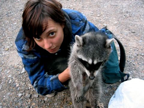
On the way there, Penny and I stopped and picked up a roadkill raccoon to possibly skin and make a coon-skin cap out of. Though as of right now (sat. 7:58pm) the raccoon still sits in Penny’s car and has sat there for two days now. Both of us feel too lazy and tired to skin it. Plus, neither one really has the supplies necessary to do so right now. I will buy them next week so when this happens again, I’ll have what I need at my moho.
Speaking of my moho, I finished putting the drive-shaft and power-steering back in this week and moved it to a more sedentary spot next to my moms house (the tow-truck just dropped it in the driveway, blocking my moms car from entering). My sister had a bunch of my stuff stashed at her house, near my moms. She moved out and I had to pick it up. Now my moho overflows with my crap. Next week I’ll have to go through it all and recycle all my old papers and take a bunch of that other stuff to Goodwill or something.
Anyway, back to Table Rock… We didn’t want the raccoon to sit in the car all day, so Penny decided to stash it under the car:
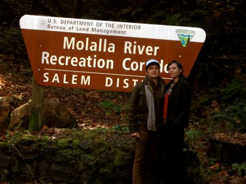
The Table Rock Wilderness sits at the south end of the Molalla River Corridor, which begins just east of Molalla. We took the photo-op as we passed the entrance sign.
A few weeks back I had done lots of searching to find just where the Table Rock Wilderness sits. I found little online and so I went to the Ranger Station in Molalla and picked up a map:
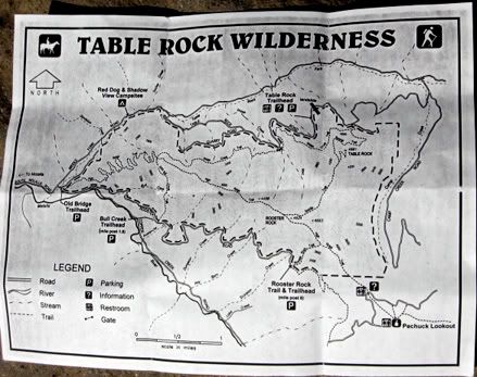
As you can see on the map, a landslide occurred in 1996 and now the trailhead sits at the dead end it created. I wonder why they never rebuilt the road? Possibly lack of funds? No logging happens up that road, so perhaps they didn’t care to rebuilt it. They probably want it to have less roads anyway, at least, I know I do.
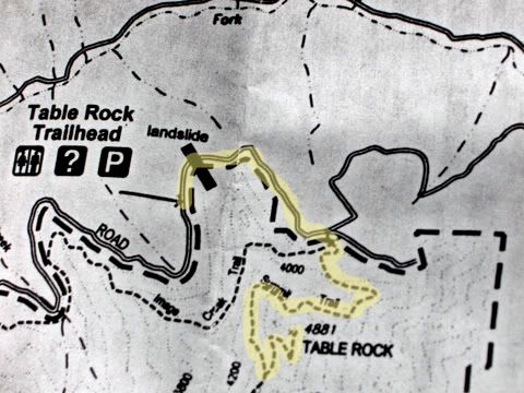
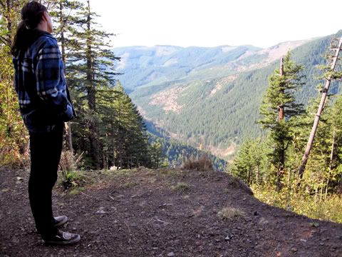
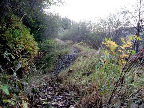
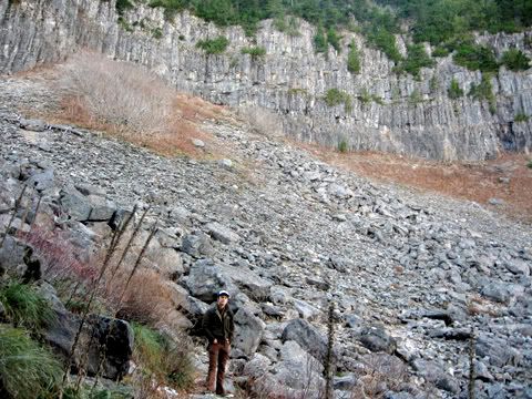
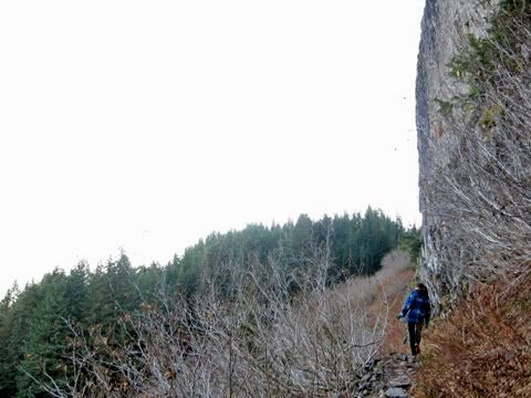
Of the 4 mile hike, the first 1.5 miles of the hike actually travels along the old road and past the landslide. I snapped this photo of Penny looking out over the landslide. It looked really huge and daunting. It probably would have cost a bundle to repair.
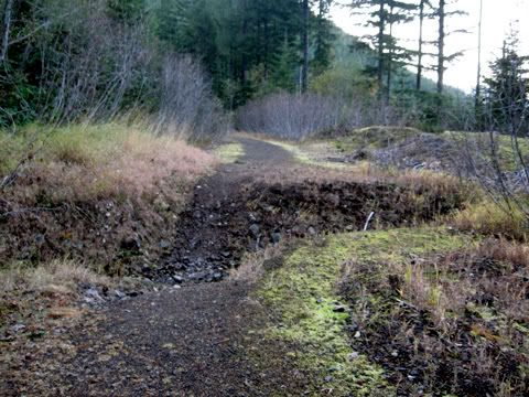
Interestingly, the old road must not have access on the other side either; it obviously had no maintenance. Many creeks had chiseled out divots in the road rendering it impossible to drive a vehicle down. It fascinated me how quickly the forest rewilded the old logging road.
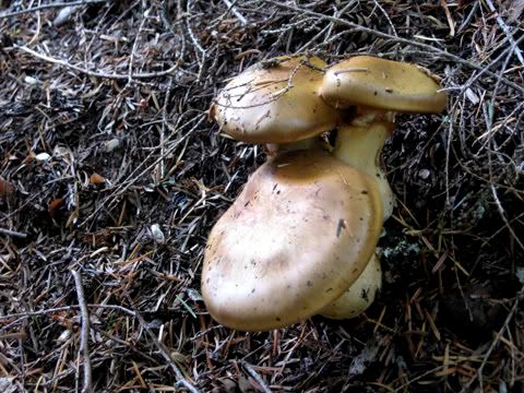
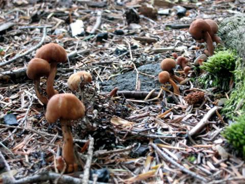
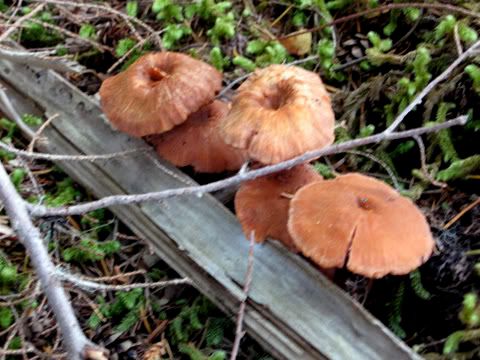
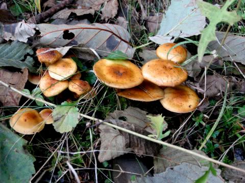
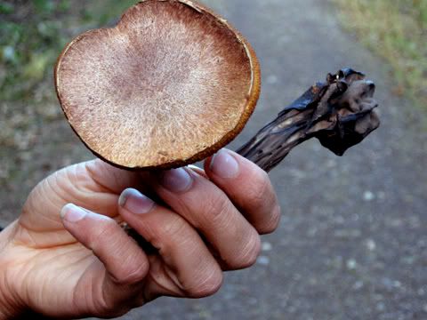
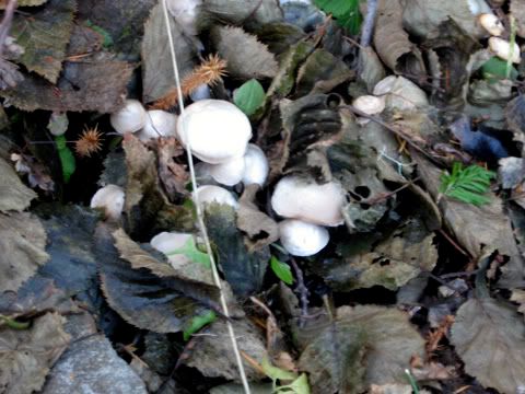
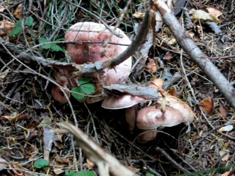
Penny looked out for mushrooms and we saw tons, though most had dried up and we couldn’t eat them. Also, we didn’t know most of them so I snapped a lot of photos for us to take home and identify. Now you also can enjoy the montage of photos:
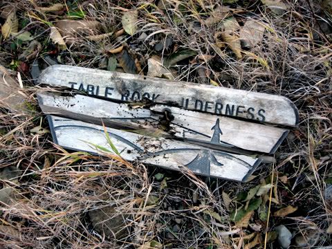
Along the old road I found this sign. You can tell no one really comes back here. According to the wikipedia article:
Relative solitude can be expected due to the Forest Service reporting approximately 900 annual visitors.
…It shows. At some places along the hike the silence in the forest made any noise sound sinful.
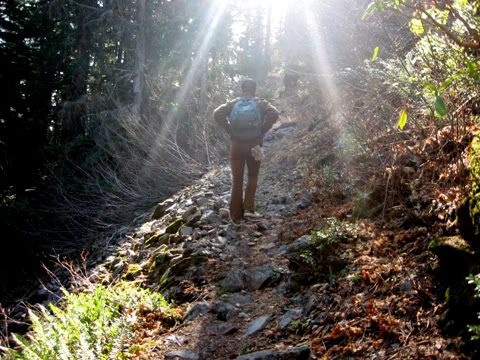
The original trailhead no longer has a sign. We saw the post though, and what looked like a trail. We followed it in and saw an old billboard with decomposing papers about Table Rock. We started up the hill there to the left. While climbing the mountain, Penny snapped this awesome, heavenly photo of me:
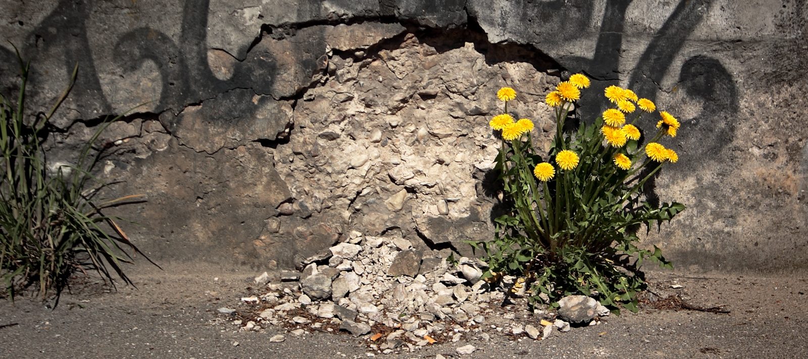
BLM land surrounds the Table Rock Wilderness. From the vantage on the mountain you can see many clear-cuts like the one below. I don’t know how anyone could do this to a piece of land. It looks horrific to me, and I mean from afar. I can’t imagine the horror of standing close up. Okay, I can imagine it because I have gone into clear-cuts before. They disgust and horrify me. It looks like a big, ugly scab on an otherwise pretty-looking forest. However I look out at the stands and notice that most of them do not have old growth and most of them consist of Doug Fir and Western Hemlock. I wonder what these forests looked like 200 years ago. 500 years ago. As I read more of Keeping It Living, I wonder how the people here managed them, I mean, related to them. This makes me really sad.
![]()
On the up side, we got to the north side of Table Rock and I had read in the wikipedia article that I would find Pika here. For those who don’t know the name Pika refers to a little rabbit-like rodent, only with short ears and a more round butt. People also frequently see them carrying big sticks and leaves in their mouths. I didn’t see any in the rocks, but I heard many of their signature “Bleek,” the cutest sound you have ever heard in your life.
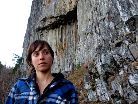
The cliffs just look amazing at this place. I kept my eyes out for an alleged petroglyph, but I never saw it. I’ll have to do a little more digging to find that location, and when I do, I probably won’t post a picture of it here! I think I would get a few “dark side” points if I did that. I already feel like I live on someone else’s land.
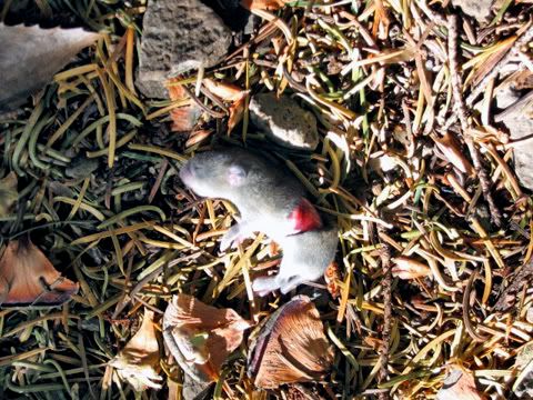
We found this dead baby pika on the trail. No idea what happened here. Looks like a little bite/slice on its back. Just dead in the trail. Stiff. Any ideas?
More beautiful cliffs. I wish I had made the hike in the spring time, as many of these dried up perennial shrubs consist of salmon berry and thimble berry. We also saw a few herbaceous perennials, but I couldn’t identify them.
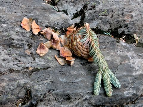
Here a little friend had a piney tasting snack some kind of spruce or fir. I haven’t looked at my guides yet (My library still sits at Willem’s house)
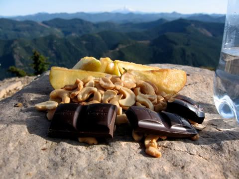
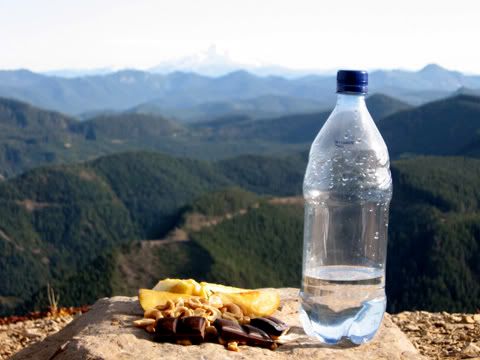
At the peak, you can see for miles. You can see Mt. St. Helens, Mt. Rainer, Mt. Adams, Mt. Hood, Mt. Jefferson, Three fingered Jack, and the Three Sisters. Supposedly, on a clearer day you can even see Mt. Shasta in Northern California. Basically, Table Rock looks like a platform into the cascades. You can see all the the western side. I found it surprising that they went on and on… Traveling down I-84 along the Columbia River, you pass through the Cascades in about an hour. From Table Rock, I could not see past the mountains to the eastern desert of Oregon.
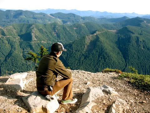
It took us three hours to get from the car to the top. At the top we found a nice rock to serve as our table. A table rock atop Table Rock. We thought it fitting, ate our lunch of nuts, fruit and chocolate. It feels good to connect with a piece of land again, it has felt like a long time for me. I think this may prove the greatest view of the Cascades in Oregon.
—
Show your support and appreciation for Urban Scout


beautiful photos and a wonderful adventure.
Pingback: November Update: A New Home, The Quest for Health, and Time To Get A Job « Penny Scout: Adventures in Feral Failure
Pingback: W49: Molalla Scout | Urban Scout: Rewilding Cascadia